
Region I is located in the Northwestern coast of Luzon and the land area is 12,840.19 square kilometers. On the west is the China Sea, on the east by the Cagayan Valley and the Cordillera Administrative Region, on the south is Central Luzon and on the north is the Bangui Bay. Ilocos region is composed of four provinces and these are Pangasinan, Ilocos Norte, Ilocos Sur and La Union. San Farnando City is the regional center which is found in La Union. The cities that comprises Pangasinan are Dagupan, San Carlos, Urdaneta and Alaminos. Candon City and Vigan City are located in Ilocos Sur. Laoag City is in Ilocos Norte while San Fernando City is in La Union.
The dialect or language that is use in this region are Ilocano and Pangasinense. Tagalog and English are the medium of instruction in schools. Ilocano is widely used by the majority people while Pangasinense is spoken in the central towns of Pangasinan.
This Region has three (3) distinct groups: Ilocanos, Pangasinenses and Igorots. Ilocanos occupy the coastal provinces of Ilocos Norte, Ilocos Sur and La Union and certain parts of Pangasinan. The natives of Pangasinan are the Pangasinenses. There are also Tingguians who live in the secluded mountains of Ilocos Sur.
The major industries of this region includes crop production, fishing, mining, manufacturing and cottage industries. This region is a leading producer of tobacco and mangos for export in the country. Region I is a prime agricultural land. This region produces crops like tobacco, rice, corn, vegetables, rootcrops and fruits such as mangoes. Region I is also rich in natural resources such as limestone for cement, feldspar for ceramics, fruits, vegetables, fish, poultry, and forest products such as bamboo and rattan. Other mineral resources include copper, gold, chromite, iron, manganese and silica. This region is known because of its longest coastlines and has numerous rivers and streams that it has extensive fishing grounds and large fishponds.
There is a road network that links Region I to the other parts of Luzon. Sea transport facilities are concentrated in the Port of San Fernando and Currimao. The Salomague Port in Cabugao has facilities as a containerized transhipment port. These are primarily for the movement of goods. The Laoag International Airport is located in Ilocos Norte where this is the main gateway to Ilocos Region. This interneaional airport caters international flights from Hongkong, Guangzhou and Taiwan. It also caters local flights via Cebu Pacific and Asian Spirit. San Fernando has also an airport but it only serves Manila - San Fernando City, La Union - Manila route through Asian Spirit.
Region I is a well developed Region. 99% of the the cities, municipalities and barangays have access to electricity and telecommunications. This region is also an energy provider where two new large power plants will be built.
Ilocos Region is hot and dry from November to April and the rainy season is from May to October.
after a 12 hours of body ache riding a bus we end up waking up in pagudpud beach, where we eat our breakfast .. and let the pictures tell the story

Pagudpud is a wide and beautiful town on the northwest tip of Ilocos Norte, Luzon, bounded to the south by the town of Bangui and to the east by the Cordillera Mountain Range, the town of Adams and the province of Cagayan. The South China Sea lies to the west and north.
after pagupud beach we went to patapat viaduct to take pictures .. but unfortunately i dont have camera (which is a big mistake that i made)

The Patapat Viaduct Is a viaduct at the municipality of Pagudpud, Ilocos Norte. elevated 31 meters over sea level, is 1.3 km concrete coastal bridge that connects the Maharlika Highway from Laoag, Ilocos Norte to the Cagayan Valley Region. It rises along the town's coastal mountains, which is the starting point of the Cordillera Mountain Range that snakes through Northern Luzon. It is the 4th longest bridge in the Philippines. is geographically located at latitude (18.5733 degrees) 18° 34' 23" North of the Equator and longitude (120.896 degrees) 120° 53' 45" East of the Prime Meridian on the Map of the world.
after that we went to Bangui Bay to see the Bangui Windmills ..

The Bangui Windmills are located in Bangui, Ilocos Norte, Philippines. The windmills, officially referred to as the NorthWind Bangui Bay Project, were a project by the NorthWind Development Corporation as a practice renewable energy sources and to help reduce the greenhouse gases that cause global warming. The project is the first “Wind Farm” in the Philippines consisting of wind turbines on-shore facing the South China Sea and considered to be the biggest in Southeast Asia. The project sells electricity to the Ilocos Norte Electric Cooperative (INEC) and provides 40% of the power requirements of Ilocos Norte via Transco Laoag.
we go see the "SALT MAKING" in Pasuquin

and then we go to check in at ILOCOS NORTE HOTEL AND CONVENTION CENTER

after a night, we wake up to go at the Malacañang of the North, in this location you can see the Legendary Paoay Lake,

- Paoay Lake

then we go to Paoay Church

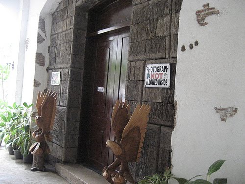
then we go to Marcos Mausoleum in Batac

the entrance where there is a signage saying no cameras allowed, because it could affect the waxed body of Ferdinand Marcos
Marcos's Quotations

Marcos's Statue

Marcos's Body

then we go to Sta. Monica Church in Sarrat

-inside Sta. Monica Church

St. William's Cathedral

Then we go to Museo Ilocos Norte to buy some souvenirs...

Ilocos Sur Capital Vigan City

Vigan Pottery

Baluarte ni Singson...

The Aniceto Mansion

Syquia Mansion of Elpidio Quirino

Calle Crisologo... the last destination we've tour in Ilocos...


Now i can check Ilocos out of my bucket list... =)